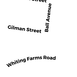
75 WHITING FARMS RD
Owner Information
UPC NORTH, LLC
75 WHITING FARMS RD
HOLYOKE, MA 01040


Property Details
75 WHITING FARMS RD is classified as a Buildings for manufacturing operations (Indust-lt).
The primary structure on this property was built in 1968. There are 94,262ft2 of built area within this property. There is 94,262ft2 of residential/living space within this property.
75 WHITING FARMS RD is valued at $2,197,000. The land is valued at $439,200 and the structures are valued at $1,709,700. There is an additional valuation of $48,100 on this property.
This property is in Zone IP. Confirm with local Zoning Board authorities to ensure there are no overlays or other easements on this property.
The most recent deed for 75 WHITING FARMS RD is recorded at the local registrar in Book 12725, Page 240. 75 WHITING FARMS RD was last sold on Monday, November 18, 2002 for $1,300,000.
Assessment data from fiscal year 2022.
Flood Data
According to the FEMA National Flood Hazard Layer, this property does not appear to be in a flood zone. It may also be in an area not yet reviewed. Nonetheless, confirm this information prior to taking any action.
To view the flood hazards around this property, create a FEMA "Firmette" Map of the area around 75 WHITING FARMS RD.
Broadband Internet Providers
| Provider | Type | Bandwidth (mbps) | |
|---|---|---|---|
| PAETEC Communications, Inc | DSL | 0 | 0 |
| CenturyLink | Fiber | 0 | 0 |
| GCI Communication Corp. | Satellite | 0 | 0 |
| HughesNet | Satellite | 25 | 3 |
| VSAT Systems, LLC. | Satellite | 2 | 1 |
| MCI | Copper Wire | 0 | 0 |
| Crown Castle Fiber | Fiber | 0 | 0 |
| Broadview Networks Holdings, Inc. | Copper Wire | 0 | 0 |
| Viasat Inc | Satellite | 100 | 3 |
| Verizon New England Inc. | DSL | 10 | 1 |
| City of Holyoke Gas & Electric Department | Fiber | 0 | 0 |
| Comcast | Cable | 1000 | 35 |
Broadband service provider data from December 2020.